

SRINAGAR: Light to heavy snowfall and light rains started lashing upper reaches of Jammu and Kashmir on Friday morning as weathermen on Saturday forecast an extended wet spell from Sunday afternoon till February 3 next as two Western Disturbances are most likely to affect J&K and its adjoining areas.
“A couple of moderate Western Disturbances most likely to affect J&K and adjoining areas from 28th afternoon onwards,” a meteorological department official said in Srinagar.
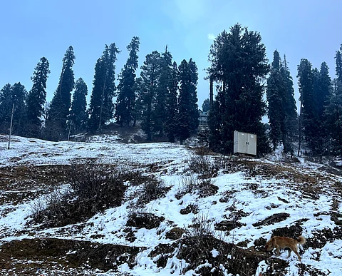
A Facebook user Umar Tramboo posted a short video of the snowfall in Gulmarg on his handle saying, “Much-awaited snowfall in the valley!Witness nature at its finest as Gulmarg is covered with beauty all around, creating a truly captivating sight.The Khyber Himalayan Resort & Spa
In rest of northern India, which has been experiencing severe cold wave over the past few weeks, the Indian Meteorological Department (IMD) has extended its forecast for dense fog and severe cold-day conditions in Uttar Pradesh and Bihar until January 29, issuing an orange alert for these states.
In the national capital, Delhi, the minimum temperature on Saturday dipped to 4.3 degrees Celsius, marking a deviation of four notches below the season’s average.
The IMD predicts rainfall or snowfall in Jammu, Kashmir, Ladakh, Gilgit, Baltistan, Muzaffarabad, and Himachal Pradesh on January 27 and 28, with moderate precipitation anticipated from January 29 to February 1. Heavy rainfall or snowfall is predicted in Jammu, Kashmir, Ladakh, Gilgit, Baltistan, and Muzaffarabad on January 28 and 31. Additionally, rainfall or snowfall is expected in Uttarakhand, Punjab, Chandigarh, Haryana, and West Uttar Pradesh from January 31 to February 2.
Under the influence of weather systems, the weathermen in Srinagar said, an “extended” wet spell from Sunday (afternoon) onwards till February 3 was most likely over J&K and adjoining areas.
He said on January 28-29, there is possibility of light to moderate rains/snow at many places with “heavy snowfall” over isolated upper reaches of Kashmir Division (Kupwara, Baramulla, Bandipora, Ganderbal, Shopian and Kulgam) during the night of January 28 late afternoon to January 29 late afternoon and evening.
Similarly, Pir Ki Gali in Pir Panjal region, adjoining Shopian and Kulgam is also expected to experience heavy snowfall in the next few days. Light snowfall has already started in Pir Panjal region including Ramban and Doda districts of Jammu region since Friday morning.
He said that “On January 30-31, there is possibility of light to moderate rain and snow at many places with chances of ‘heavy snowfall’ over few upper reaches (Kupwara, Baramulla, Bandipora, Ganderbal, Shopian and Kulgam).
From February 1-3, he said, there is possibility of light to moderate rain and snow at many places.
“There is possibility of intermittent light to moderate rain with thunder and lightning in plains of Jammu Division with light snowfall over higher reaches and moderate snowfall over isolated higher reaches during 28th night to 3rd February (afternoon).”
The MeT office issued advisory, saying that the system may lead to temporary closure of roads of higher reaches and important passes like Sinthan pass, Mughal Road, Sadhna and Razdan Pass, Zojila etc. particularly during January 28-31.
“Travellers are advised to plan accordingly,” he said. The traffic police has also issued an advisory for the movement of vehicles on all roads connecting Jammu and Srinagar besides other places in the mountain regions of entire J&K due to weather conditions. It also advised intending travellers not to undertake journey during the night hours on any of the Highways to either Jammu or Srinagar.
The weatherman said farmers are advised to withhold irrigation and fertilizer application and drain out excess water from orchards and fields during the period.
“A significant drop in day temperature is expected during the period,” he said.
Meanwhile, night temperature hovered above normal at most places barring twin capitals with Srinagar recording a low of minus 2.3°C against minus 0.5°C on previous night and it was 1.3°C below normal for the summer capital of J&K for this time of the year.
Qazigund recorded a minimum of 2.2°C against minus 0.2°C on the previous night, he said. The minimum temperature was 0.4°C above normal for the gateway town of Kashmir, the MeT official said.
Pahalgam recorded a low of minus 5.1°C against minus 0.4°C on the previous night and it was 1.0°C above normal for the famous resort in south Kashmir.
Kokernag, also in south Kashmir, recorded a minimum of minus 0.8°C against minus 0.1°C on the previous night and the temperature was above normal by 1.8°C for the place, the official said.
Kupwara town in north Kashmir recorded a low of minus 2.4°C against 2.5°C on the previous night and it was 0.1°C above normal there, the official said.
Gulmarg, the official said, recorded a low of minus 6.4°C against minus 3.7°C on the previous night and the temperature was 1.1°C above normal for the world famous skiing resort in north Kashmir.
Jammu, he said, recorded a minimum of 7.0°C and it was below normal by 1.7°C for the winter capital of J&K.
Banihal recorded a low of 0.4°C, Batote 3.1°C and Bhaderwah minus 0.2°C, he said.
Kashmir valley is under ‘Chillai-Kalan’, the 40-day harsh period of winter, which will end on January 29. However, it does not mean an end to the winter. It is followed by a 20-day-long period called ‘Chillai-Khurd’ that occurs between January 30 and February 19 and a 10-day-long period ‘Chillai-Bachha’ (baby cold) which is from February 20 to March 1.
Extended dry spell can impact biodiversity
The snowfall begins amid extended dry spell over the past six weeks posing a significant threat to the region’s biodiversity. Experts have already warned of adverse impacts on water bodies, glaciers and key sectors such as agriculture, horticulture and tourism.
The region was currently undergoing an extended period of dry weather during the 40-day harsh winter phase known as Chillai Kalan, the coldest stretch of winter observed from December 21 to January 30 annually.
Jammu and Kashmir experienced a rainfall deficit of 79% in this period, recording 12.6 mm rainfall in December 2023, which is below the average of 59.6 mm, as per the official data from the India Meteorological Department. The dry spell has continued in January, which is considered the coldest month when the valley normally receives maximum snowfall.
The region has also been experiencing temperatures 6-8 degrees Celsius above the winter average. On January 13, the city of Srinagar recorded a maximum temperature of 15 degrees Celsius, marking the highest January temperature in the past two decades.
Director of the Meteorological Department in Kashmir, Mukhtar Ahmad, attributed this dry weather to El Niño.
El Niño is a climatic phenomenon that occurs when there is an unusual warming of surface waters in the eastern tropical Pacific Ocean, representing the warm phase of the El Niño-Southern Oscillation. This warming leads to increased sea surface temperatures in the central and eastern tropical Pacific Ocean.
The elevated temperatures induce a shift in atmospheric circulation, causing reduced rainfall over Indonesia, India and northern Australia. Conversely, it enhances rainfall and the formation of tropical cyclones over the tropical Pacific Ocean.
In Kashmir, El Niño‘s impact is observed through prolonged periods of dry weather, milder winters and reduced snowfall. Ahmad notes that the weather in Kashmir was previously influenced by the El Niño effect in January 1998, December 2014, January 2015 and December 2018, a report in Mongabay said.
Extreme weather patterns
The weather pattern of 2023 and January 2024 in Jammu and Kashmir witnessed contrasts and extremes, points out independent weather forecaster Faizan Arif.
“From a 42% surplus [rainfall] in January 2023 to a significant 79% shortfall in December 2023, Jammu and Kashmir experienced an overall 7% deficit in rainfall last year, illustrating the varied and unpredictable nature of the weather throughout the year. Similarly, we have had a snowless winter so far owing to which various key sectors would get affected,” he said.
In fact, after seven years, Kashmir is experiencing a snowless winter, said Irfan Rashid, a senior assistant professor at the Department of Geo-informatics, University of Kashmir. “The snow in Chillai Kalaan is important for regulating glacier health and stream flows. The dry winters would mean higher mass loss of glaciers in this hydrological year. If the weather conditions do not improve, it might impact hydro-power generation, irrigation, agriculture, and dependent sectors,” he said.
The prolonged dry spell has negatively impacted crucial water sources, particularly the Jhelum river and other streams. Substantial decreases in water levels in surface sources have been noted, with the Jhelum river hitting its lowest point over the last many years.
On January 14, the river’s flow was measured at minus 0.75 feet at Sangam (Anantnag district in south Kashmir), marking a level not seen since November 2017 and minus 0.86 feet at Asham (Bandipora district in north Kashmir). A negative reading indicates that the gauge reading is at or below the agreed-upon zero level of the river.
“The deficiency in timely snowfall and rainfall has led to a significant reduction in the water levels of surface water sources. It could cause water scarcity in the coming weeks,” said Sanjeev Malhotra, Chief Engineer of the Jal Shakti Department in Kashmir.
Insufficient water is impacting irrigation for agriculture and horticulture in the region, particularly orchard fields in Kashmir. An apple grower from north Kashmir’s Baramulla district Bashir Ahmad says that the absence of precipitation will negatively affect orchards in the upcoming season.
“Snow also serves as a protective layer, protecting trees from extreme cold and providing essential chill hours for dormancy. The absence of this natural shield puts trees at risk and could reduce their productivity,” he added.
Akhtar H Malik, a scientist at Department of Botany, University of Kashmir, adds that seed germination will also likely be affected without enough adequate chill and water. “The seeds require a chilling period in winter to germinate effectively during the spring season. Insufficient soil moisture during this period can adversely affect crop growth, leading to a decline in productivity,” he told Mongabay India.
Dry weather also increases the risk of forest fires. “The lack of precipitation leads to dry air, making even a small spark escalate into significant fires, as observed in the past month,” explained Malik. He notes that the dry conditions further impact wildlife by pushing them towards residential areas during forest fires.
Cascading effects
Noted geoscientist and Vice Chancellor of the Islamic University of Sciences and Technology Kashmir, Shakil Ahmad Romshoo highlights that the absence of rain or snowfall would also elevate pollutant levels in the Kashmir Valley and pose health risks.
The prolonged dry spells and rising temperatures could also lead to significant consequences on glacier melting. “Glaciers are already melting due to climate change. Now dry weather and rising temperature will adversely affect glaciers in the Kashmir Himalayas,” he told Mongabay India.
Rashid adds that this could lead to hazards including Glacial Lake Outburst Flooding (GLOF), rock-ice avalanches, glacier detachments, and debris flows. GLOF is the term scientists use to describe when the water levels in glacial lakes breach their boundaries, causing large amounts of water to flow into nearby streams and rivers, creating flash floods.
Effect on tourism
The absence of snow has also impacted winter tourism in the region, particularly in Gulmarg and Pahalgam.
Places like Gulmarg are popular with tourists who typically flock to the region for skiing from December to March. Normally blanketed in snow, Gulmarg currently stands bare, impacting major skiing events and seasonal courses in various educational institutions.
Have you liked the news article?